About Forest Maps
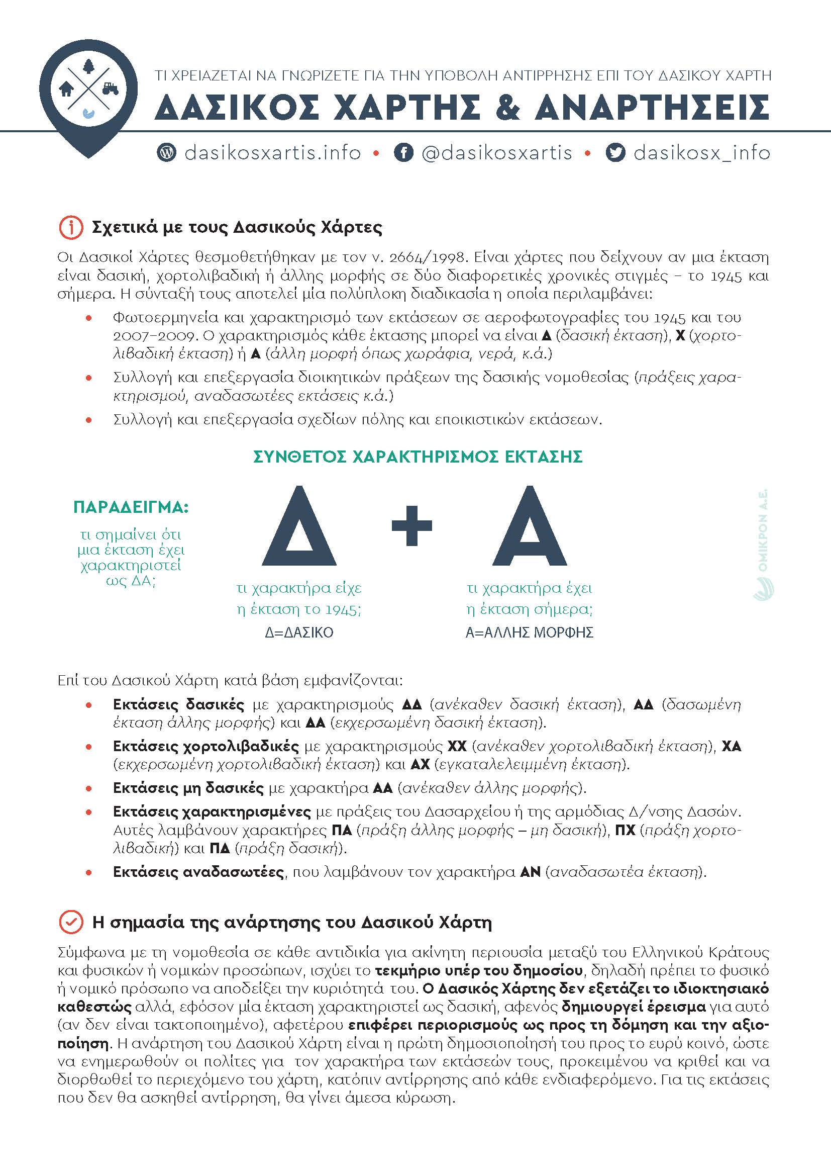
The forest maps were instituted by Law 2664/1998 (Government Gazette 275 / A / 3-12-1998). They are maps showing which part of the land was in 1945 and still is designated as forest or grassland or other (non-forest) or a combination of the above.
The Forest Map dictates for each area a character that is complex e.g. AA where D depicts the historical state of the land in 1945 (forest) and A the recent state of the land in 2007-2009 (other form – non-forest).
On the Forest map the signs displayed are:
The publication of the Forest Charter is its first public disclosure to inform the citizens of the nature of their land, so that it can be judged and also corrected by the tribunals, following objections from anyone concerned. It is the only opportunity for any natural or legal person with a legitimate interest to uphold the rights of the land they own and to prove on scientific grounds that the land owned, is owned and has never been designated forest if so. The means given to him by law is to object. For areas of the Forest Charter for which no objection will be raised, immediate approval and ratification will be made as forest land.
Objection to the Forest Charter
The objection is the only means by which any natural or legal subject facing a legitimate interest can propose substantive changes to the designated areas of the Forest Map.
The content of an objection must state reasons solely for questioning the nature or form of the areas shown on the Forest Charter. In particular, an objection may be raised either because an area has been designated as a forest (while it is not) or, conversely, because an area has been omitted as a forest (while it is).
The steps that need to be taken from the posting to the objection appear in a simple and illustrative way in the brochure.

The company offers individuals a range of services related to land parcels designation with Forest Map postings. The company undertakes all the work from the evaluation of the land qualifications to the IO. and building the best approach to objecting to the final submission of the physical file and filing with the EEA. In detail, the work that can be done is shown in the brochure.
OMIKRON SA in cooperation with GAIA Business SA have jointly developed the new "Agricultural Land Advisory Service" which provides the professional farmer with all the necessary information regarding the designation of his parcels on the posting and guides him to accomplish all the necessary documents for an efficient enforcement of regulatory requirements under National Forest and Rural Law.

The Service
Through this digital advisory service, you can find out about the posting of forest maps and regulatory adjustments that arising from forestry related legislation, aiming in securing both your basic reimburshment and other agricultural funding, resulting from Connected Schemes and Rural Development Measures, and on the other hand, ensures the continuation of rural activity.
Key Benefits:
Advantages
Implementation
The service is provided through the affiliate JSB / JS. By selecting the optimal solution, the JSB / CFD staff proceeds with the selection of farmer's selected options, ensuring a seamless completion of the necessary process including automatically filling in relevant applications and drawing up documents and charts (where appropriate). At the same time, guidance in full is provided on the successful completion of the dossier with all the relevant supporting documents for submission to the competent forestry authorities.
Express your interest
Please fill in the form below and a company representative will contact you soon.


